Airace One
With Airace One, quickly set up the GNSS receiver and start collecting points or stake them out.
Elevate your GNSS surveying experience with Airace One, our intuitive Android app designed to streamline your workflow. Seamlessly connect to Airace RTK receivers via Bluetooth, harnessing precise NMEA data while accessing RTCM corrections through NTRIP and LORA Radio.
With Airace One, conducting surveys becomes effortless; mark points with pinpoint accuracy, stake out locations with ease and export your data for further analysis. Whether you're in construction, agriculture, or land surveying, Airace One is your trusted companion for precise GNSS data collection and analysis, empowering you to achieve unparalleled results in the field.
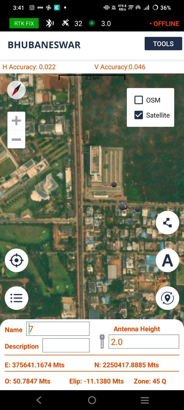
Efficient data collection and stakeout


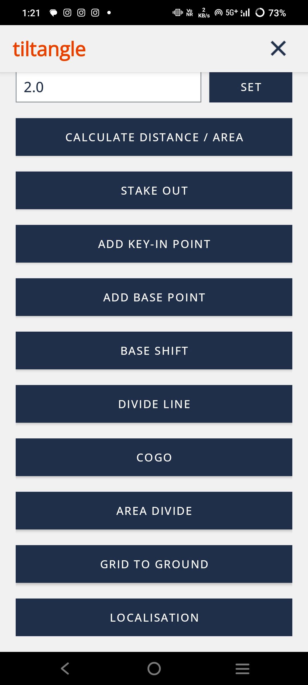
Bluetooth Device Configuration
Discover unparalleled flexibility with Airace's Device Configuration Options. Seamlessly switch between rover and base modes to adapt to your surveying needs on the fly.
Customize your device's WiFi configuration for optimal connectivity in any environment. Fine-tune hardware system settings, log configurations, and port settings with ease, ensuring your device operates exactly as needed.
With RTK configuration capabilities, achieve unparalleled precision in your GNSS surveys. Airace puts the power of customization in your hands, empowering you to tailor your device to meet the demands of any project.
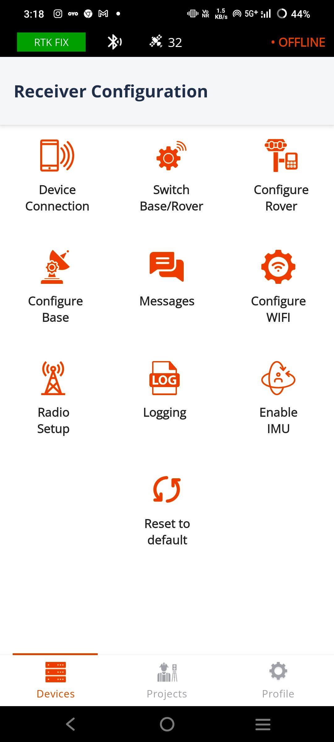
Save Live Point
Airace One enhances your field data collection capabilities. With Airace One, you can instantly save live points directly from your device, capturing crucial data in real-time.
Whether you're conducting surveys, mapping terrain, or monitoring assets, this app ensures that no valuable information is missed. Seamlessly integrate these live points into your projects, enabling efficient decision-making and accurate analysis.
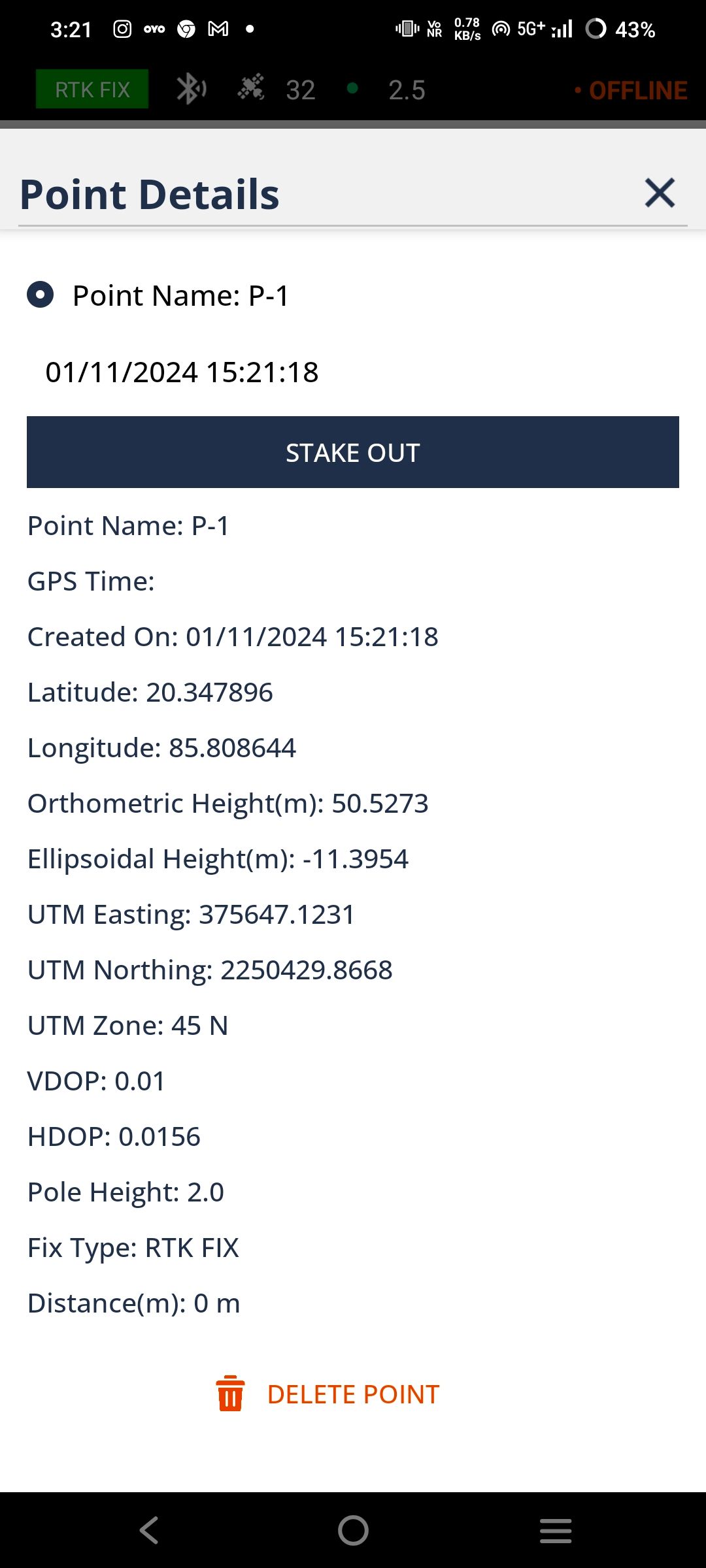
Intuitive Measurement Tool
With this intuitive tool, you can effortlessly measure lengths and areas between points with unparalleled accuracy. Whether you're mapping out boundaries, assessing distances, or planning construction projects, the Measurement Tool provides you with the data you need to make informed decisions.
Simply select your starting and ending points, and let the app do the rest. Instantly calculate distances between points or outline areas with ease. With Airace One, you have the power to conduct detailed measurements directly from your device, empowering you to achieve optimal results in every project.
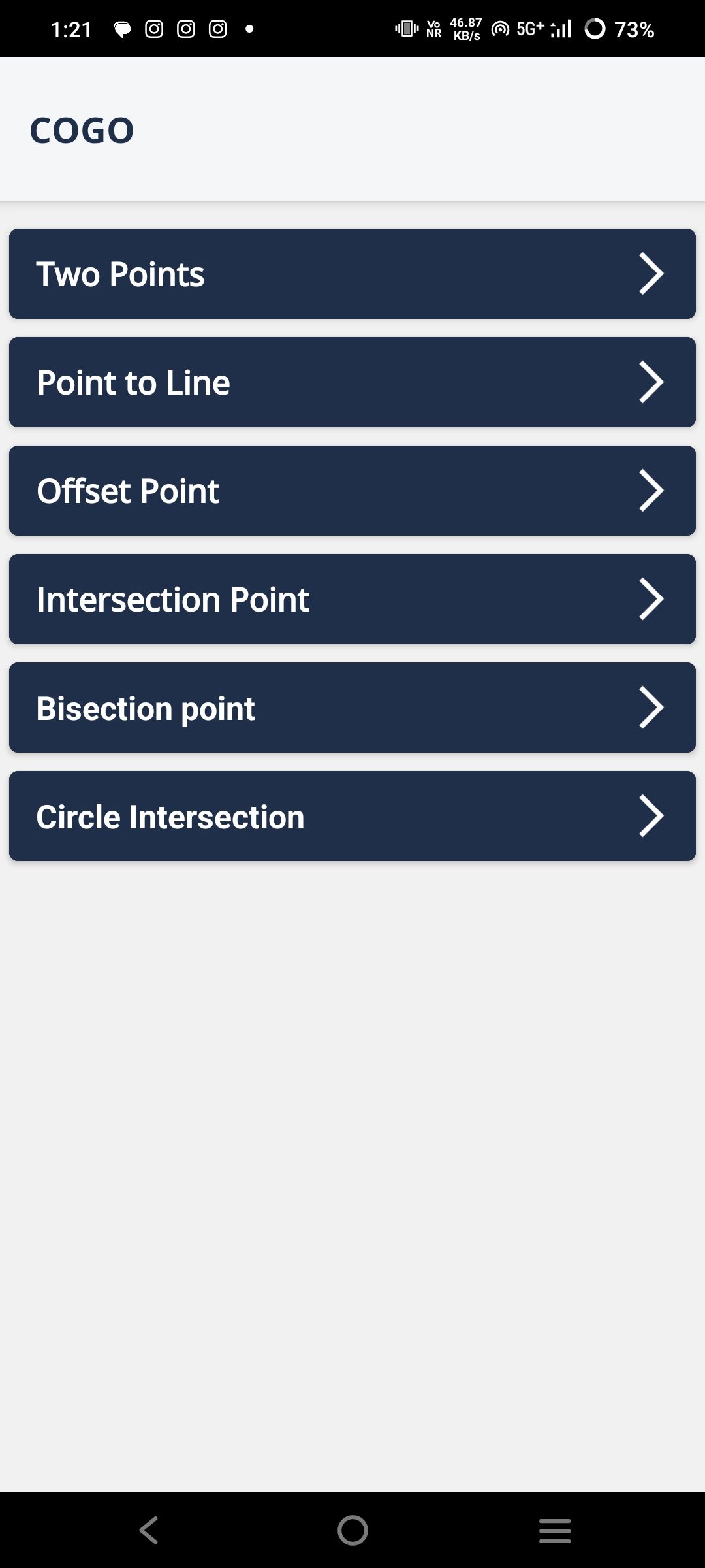
COGO Support
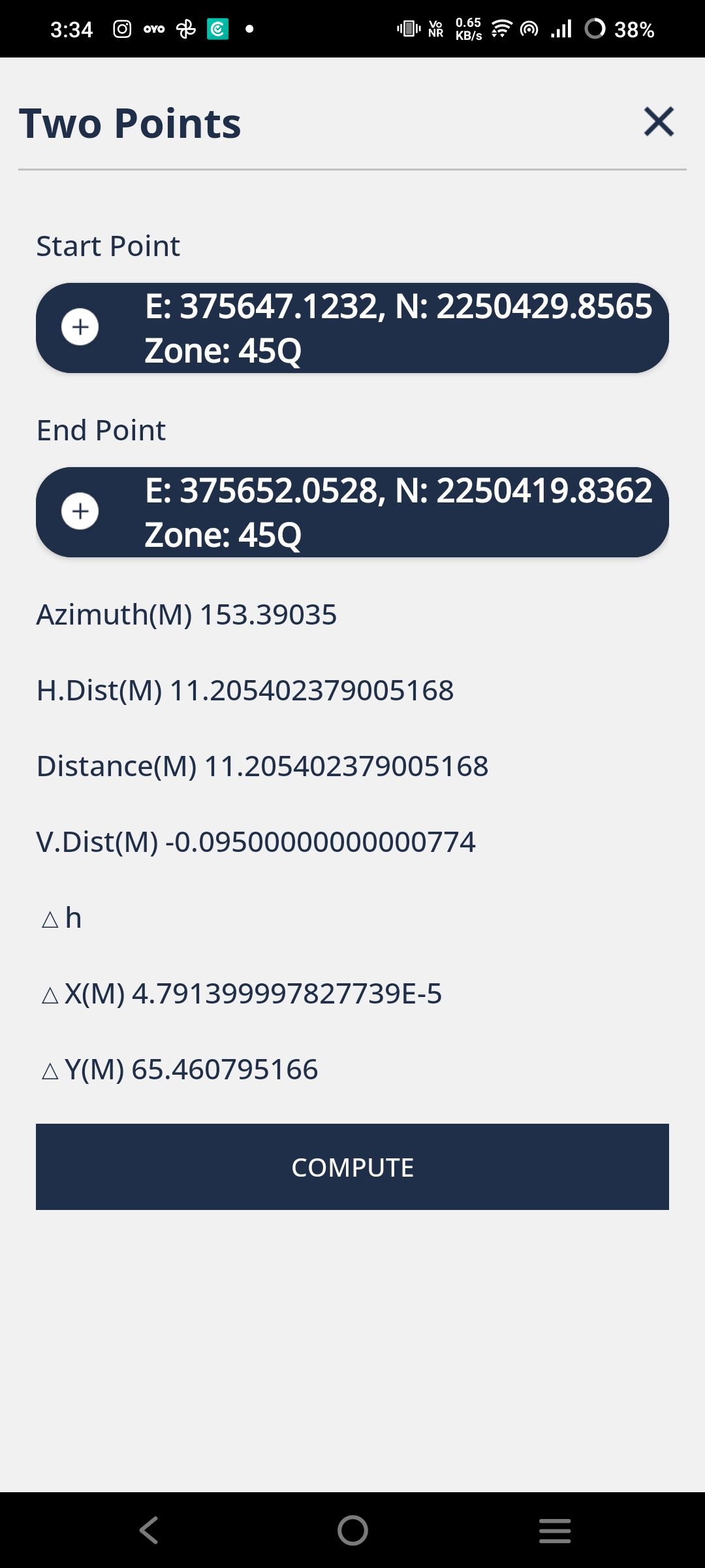
Our app supports COGO (Coordinate Geometry) calculations, allowing surveyors to compute distances, angles, and coordinates directly in the app. This streamlines complex field calculations and improves accuracy.
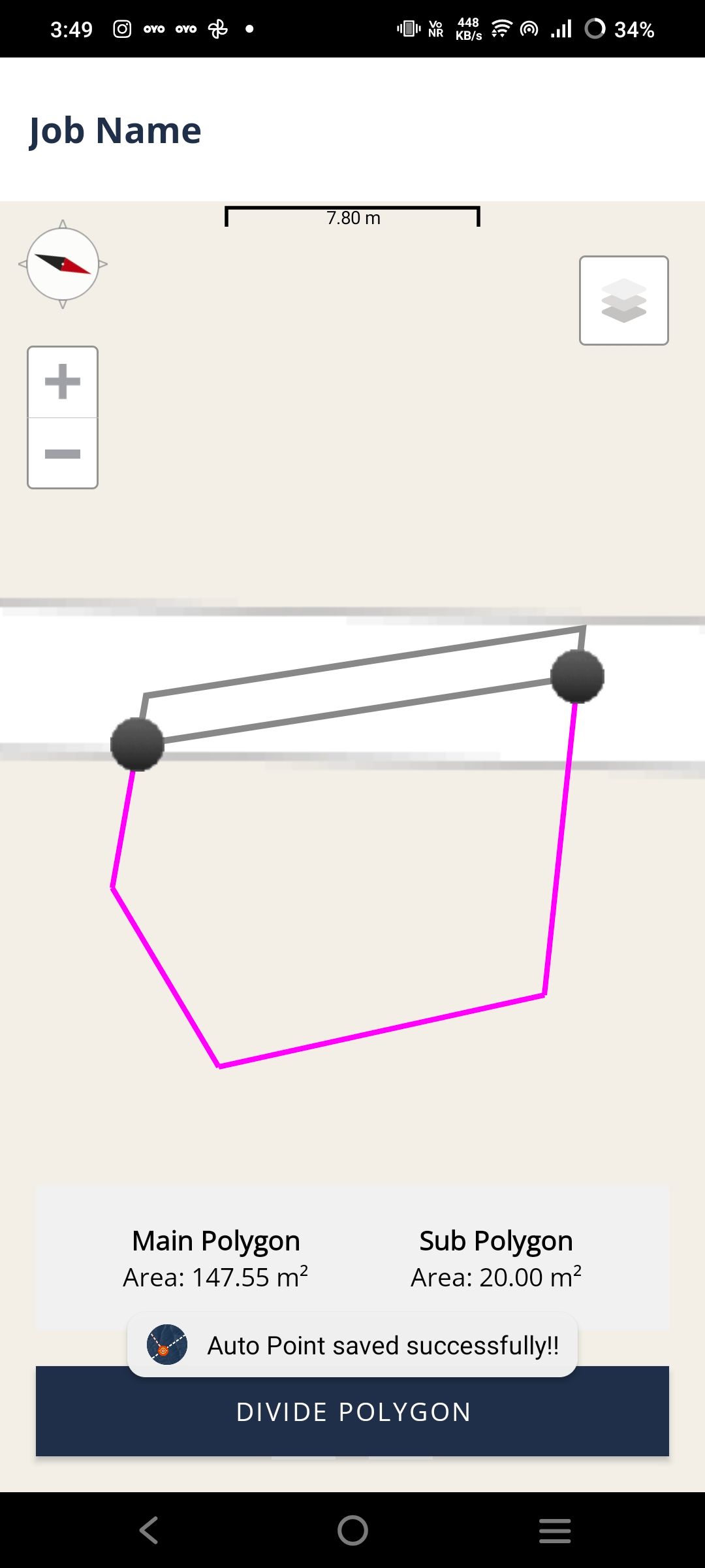
With COGO, surveyors can handle tasks like boundary layout and area division without external tools, making workflows faster and minimizing data errors.
This feature aligns with industry standards, helping professionals conduct surveys more efficiently and precisely for optimal project outcomes.
Draw Lines and Polygons
With this versatile tool, you can sketch lines, mark points, and outline polygons effortlessly, unleashing your creativity and enhancing your mapping experience.
Whether you're planning routes, delineating boundaries, or annotating key features, the Drawing Tool offers the flexibility to bring your ideas to life on the map. Simply select your desired drawing mode, and start creating – it's that easy!
With Airace's Drawing Tool, the possibilities are endless. Empower yourself to express your ideas visually and collaborate effectively with stakeholders, making your mapping endeavors more interactive and impactful than ever before.
Seamless Connectivity
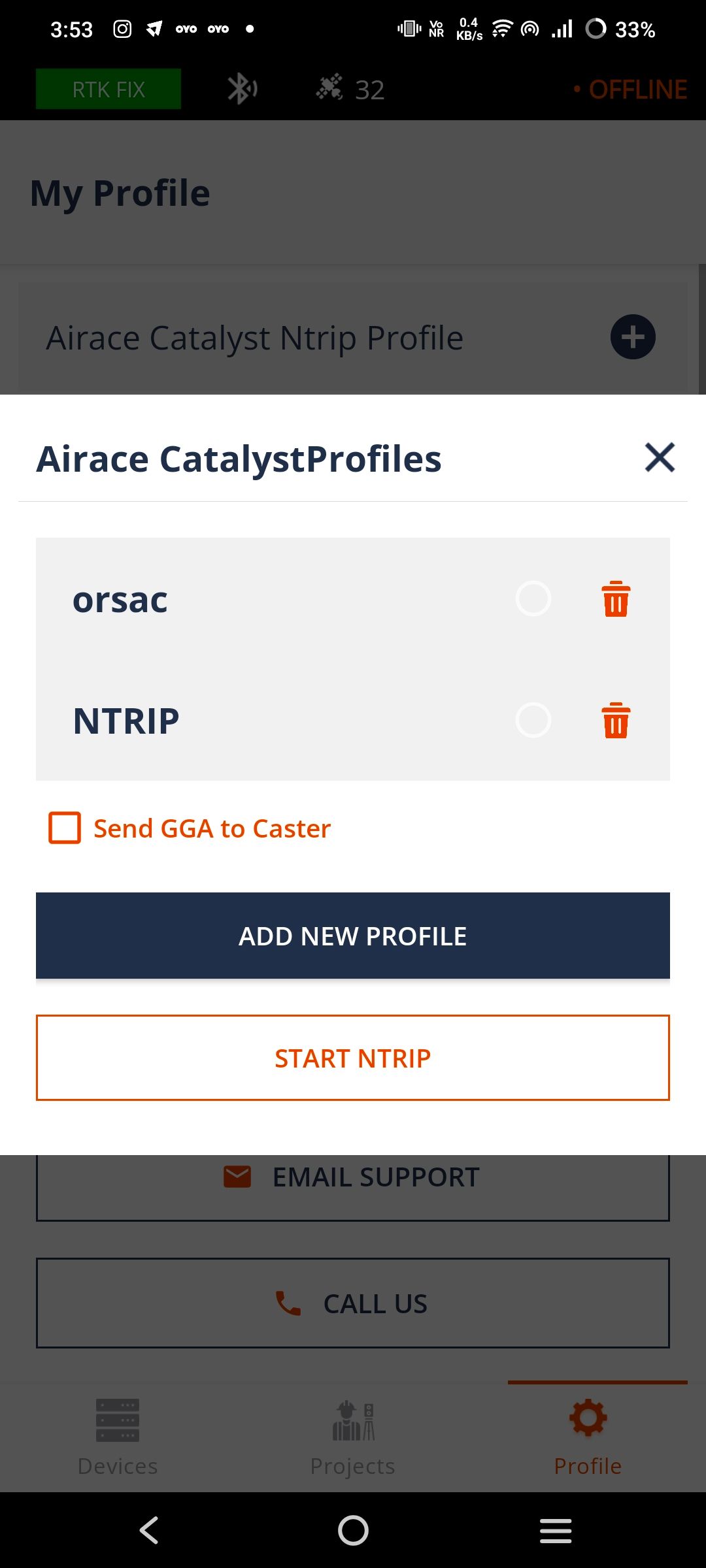
Experience seamless integration with Airace RTK receivers through Bluetooth connectivity and NTRIP connection via Airace Catalyst NTRIP caster.
Our innovative technology ensures effortless communication between your device and Airace RTK receivers, facilitating smooth data transmission and enhancing your GNSS surveying experience.
With Airace One, you can trust in reliable connections that enable precise data collection and real-time corrections, empowering you to achieve optimal results in every surveying task.
Local language support
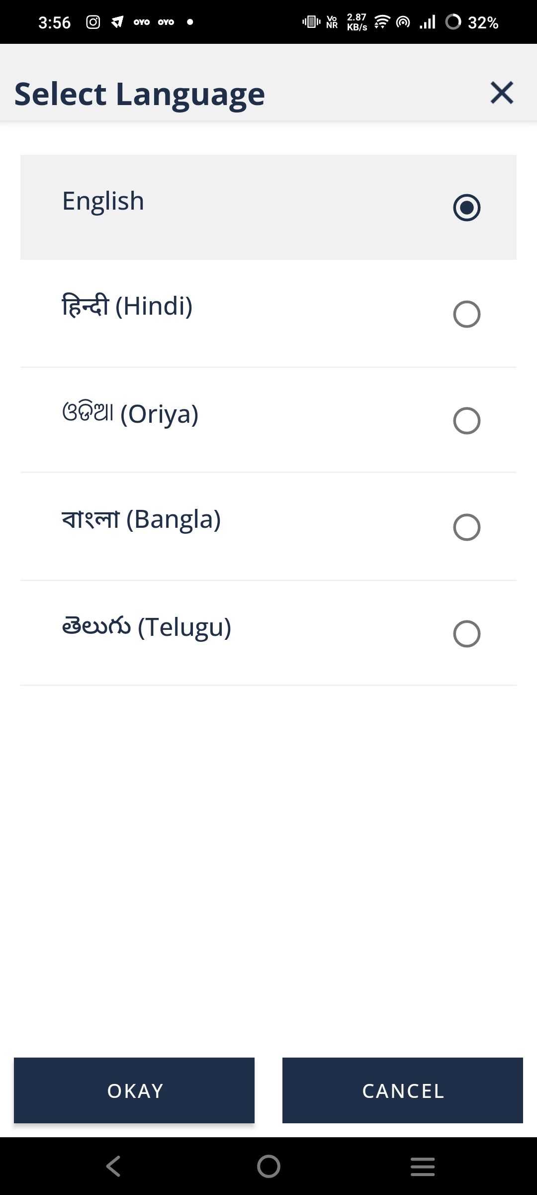
Our app’s support for multiple Indian languages, including Hindi, Bangla, Odia, Telugu, Kannada, Marathi, and Tamil, enables surveyors to work in their native language. This feature simplifies navigation and operation, breaking language barriers for a smoother user experience.
Providing instructions and data in familiar languages allows surveyors to work more accurately and confidently. Local language support minimizes misunderstandings, ensuring that even users with limited English proficiency can fully utilize the app.
This multilingual approach also makes advanced GNSS technology accessible to more professionals. It helps surveyors focus on fieldwork without needing translations, boosting productivity and efficiency.
Local Measurement Units
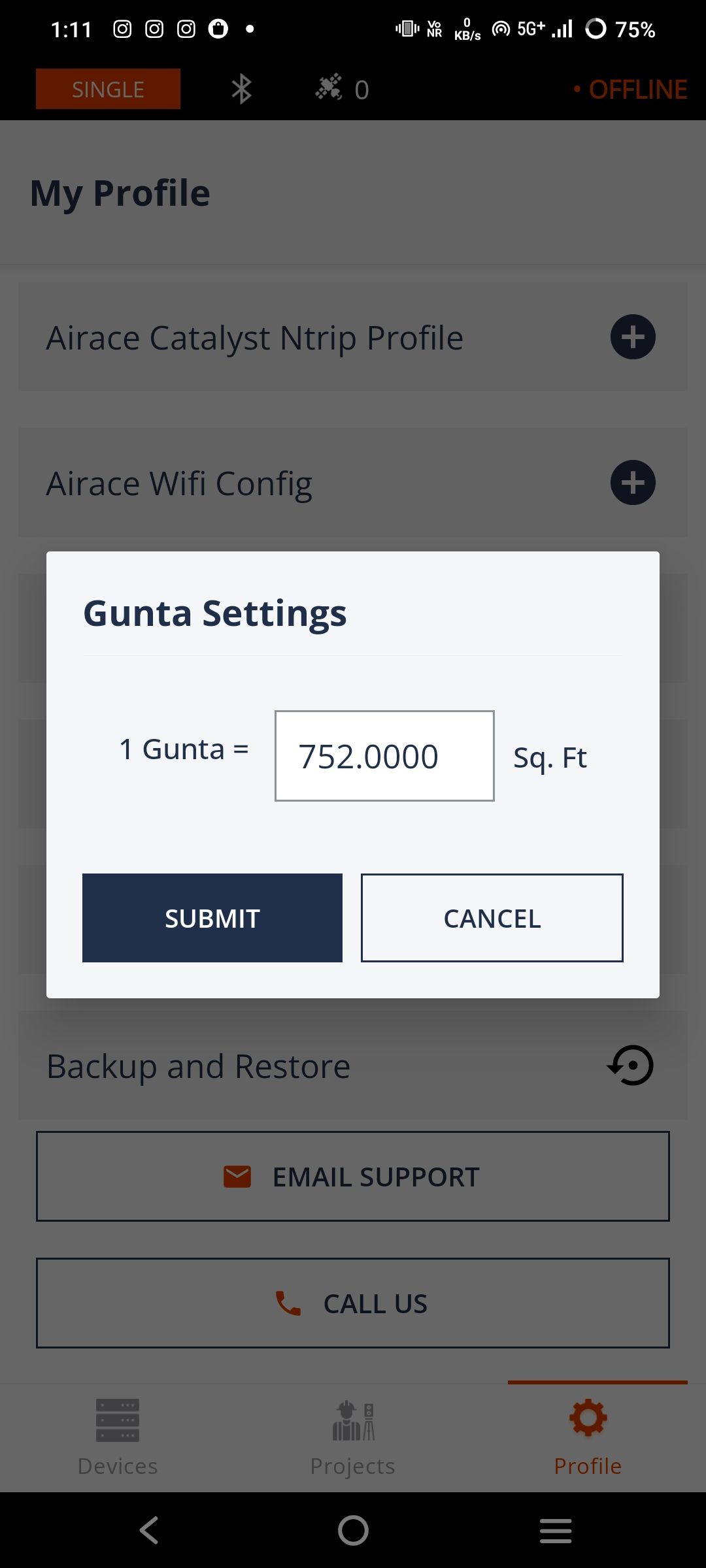
Our app’s support for local land measurement units, including Gunta, Bigha, and Katha, alongside standard units like square feet, enables surveyors to work in familiar units. This feature enhances usability, making it easier for professionals to record and interpret measurements accurately.
By offering both local and standard units, surveyors can seamlessly switch to the units most relevant to their region. This reduces errors and simplifies calculations, allowing users to focus more on their work without the need for constant conversions.
This flexibility in unit options increases the app’s accessibility across diverse regions. It ensures that surveyors can operate more efficiently and confidently, using units that align with local practices and industry standards.
Have a query?
Ready to streamline your surveying needs?
Explore Airace One Mobile App today!
Fill up the form and get started
Precision, reliability, and portability -
Navigating the future with our Geospatial
solutions.
HEAD OFFICE:
677, 1st Floor, Suite 1024, 27th Main
13th Cross, Sector-1, HSR Layout,
Bangalore, Karnataka 560102, India
CORPORATE OFFICE:
Plot no: 333/1347, Basuaghai,
Saimandir Square, NH-316, Cuttack-Puri Bypass,
Bhubaneswar, Khurdha, Odisha - 751018, India
+91 91242 55101
info@airace.in
Copyright © 2026 |
Airace Technologies Private Limited


