Airace Onehub
Online portal to track surveys and perform geospatial analysis
Unlock powerful geospatial analysis tools to gain valuable insights into your project data. Visualize and analyze spatial information to make informed decisions and optimize project outcomes.
With Airace OneHub, you can effortlessly add operators, track their work progress, and manage your projects with ease. Stay informed about every aspect of your projects, from initiation to completion, all within one centralized platform.
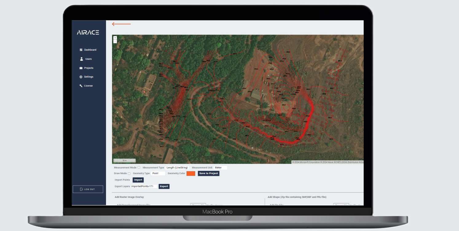
Live Tracking
Introducing our cutting-edge Live Tracking Operator feature, revolutionizing how you monitor field operations directly from our portal. With this advanced functionality, you gain real-time insights into the whereabouts and activities of your operators, ensuring enhanced visibility and control over your projects.
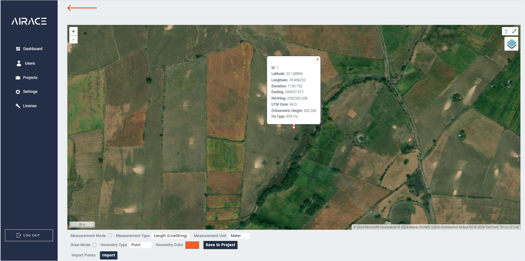
Import / Exports Data in multiple formats
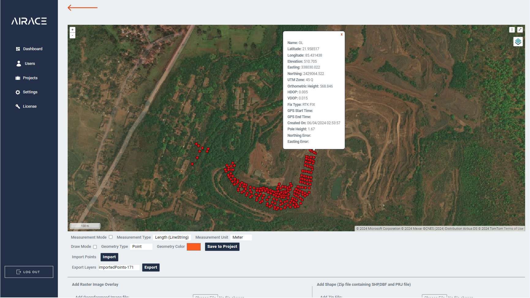
Introducing our versatile Import and Export Points Data feature, designed to streamline your workflow by seamlessly accommodating various data formats. With robust support for CSV, DXF, KML, and SHP formats, you can effortlessly import and export point data from and to different sources within our platform.
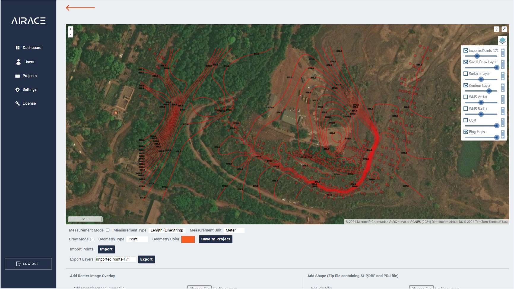
Surface and Contour Creation
By leveraging the point data uploaded to our platform, our intuitive algorithms calculate surface models and generate contour lines, providing valuable insights into the topography of your area of interest. Whether you're analyzing terrain for engineering projects, land development, or environmental studies, our Surface and Contour Creation feature offers precise and visually appealing results.
Distance and Area Measurement
Experience the convenience of measuring distances and areas in various formats with our user-friendly interface. Airace Onehub offers versatile functionality to calculate distances and areas in multiple units and formats. With support for meters, kilometers, feet, square meters, square kilometers, square feet, acres, and hectares, you have the flexibility to work with your preferred units seamlessly.
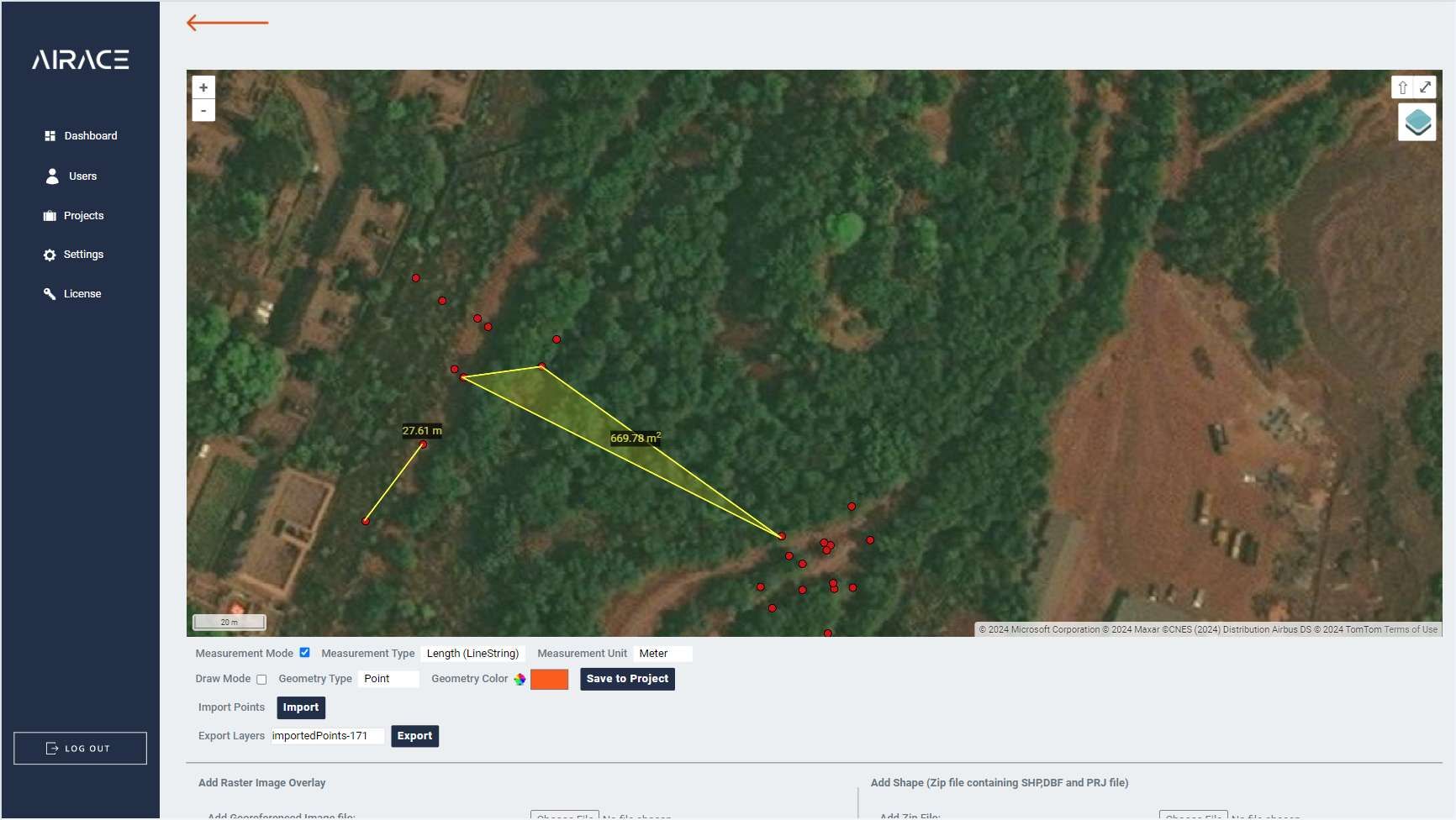
Drawing Tools
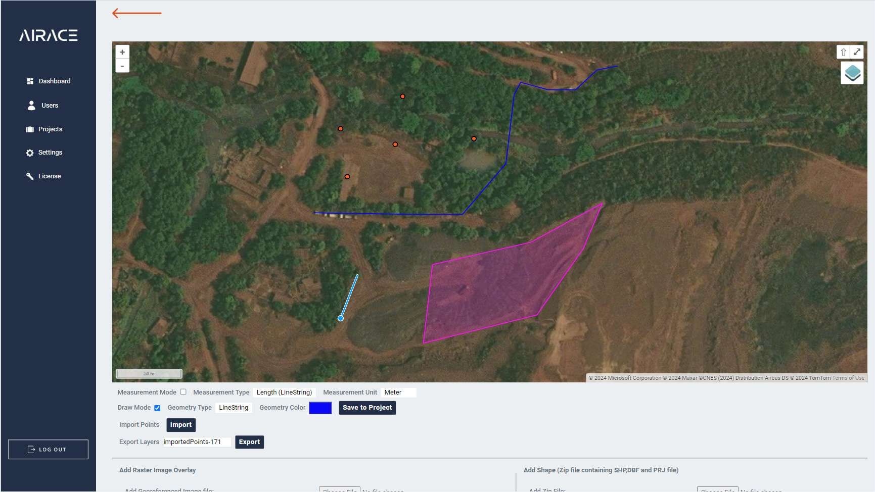
Whether you're planning routes, outlining boundaries, or highlighting specific areas of interest, our Draw Tool offers the flexibility to create precise and detailed drawings directly on the map. Simply select the desired drawing mode, and start sketching - it's that easy!
With support for points, lines, and polygons, you can capture various spatial elements with precision. Customize your drawings with different colors and styles to enhance visibility and convey important information effectively.
Work with WMS layers on the go
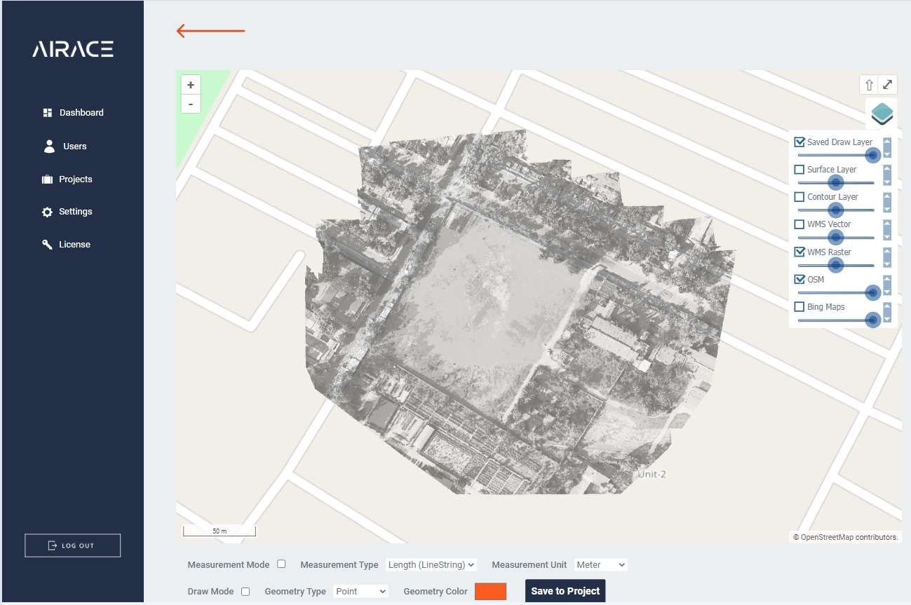
Whether you're in the field collecting data, conducting surveys, or in the office planning projects, our platform allows you to integrate raster imagery and vector data layers seamlessly. Visualize high-resolution satellite imagery, aerial photographs, and topographic maps alongside vector layers such as roads, buildings, and land parcels, providing comprehensive context for your projects.
Have a query?
Ready to streamline your projects and dive deeper into geospatial analysis?
Explore Airace OneHub today!
Fill up the form and get started
Precision, reliability, and portability -
Navigating the future with our Geospatial
solutions.
HEAD OFFICE:
677, 1st Floor, Suite 1024, 27th Main
13th Cross, Sector-1, HSR Layout,
Bangalore, Karnataka 560102, India
CORPORATE OFFICE:
Plot no: 333/1347, Basuaghai,
Saimandir Square, NH-316, Cuttack-Puri Bypass,
Bhubaneswar, Khurdha, Odisha - 751018, India
+91 91242 55101
info@airace.in
Copyright © 2026 |
Airace Technologies Private Limited


